Author: Devika R
August 15, 2026
8 min read
Subtitle: Why infrastructure projects are changing what BIM professionals need to know.
1. BIM Isn't Just for Buildings Anymore
When people hear BIM, they often picture a building.
Revit. Walls. Floors. MEP systems. Clash detection.
But look beyond the building site.
Think about a highway stretching across kilometres of terrain, a metro line passing through a busy city, a bridge crossing a river, or an airport connecting multiple transport systems.
These projects have something in common:
They are becoming increasingly digital, coordinated, and data-driven.
That is where Infrastructure BIM comes in.
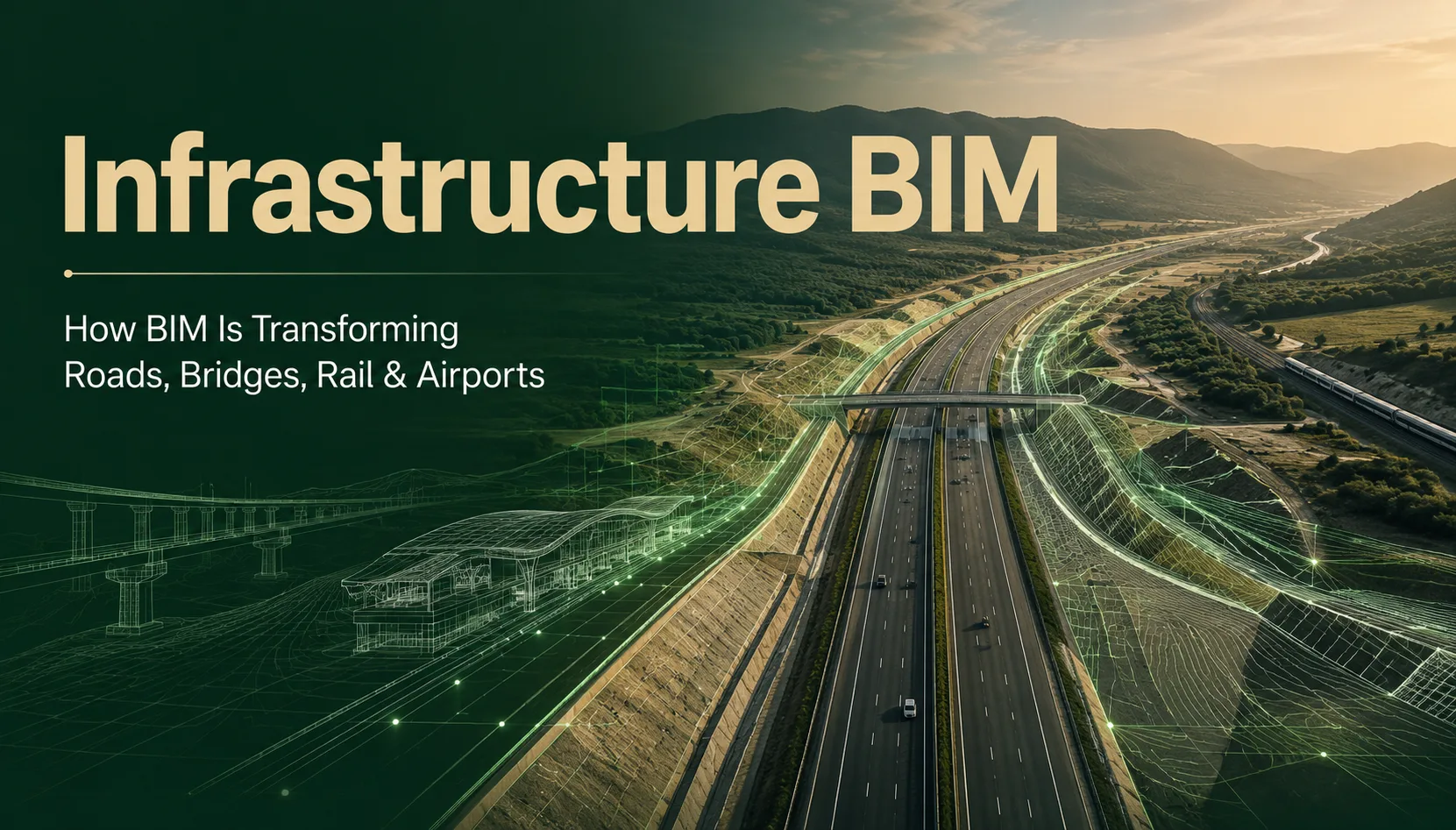
BIM for infrastructure brings model-based working, collaboration, engineering data, and real-world context into projects that are often far more geographically complex than a single building.
2. Why Infrastructure BIM Is Different
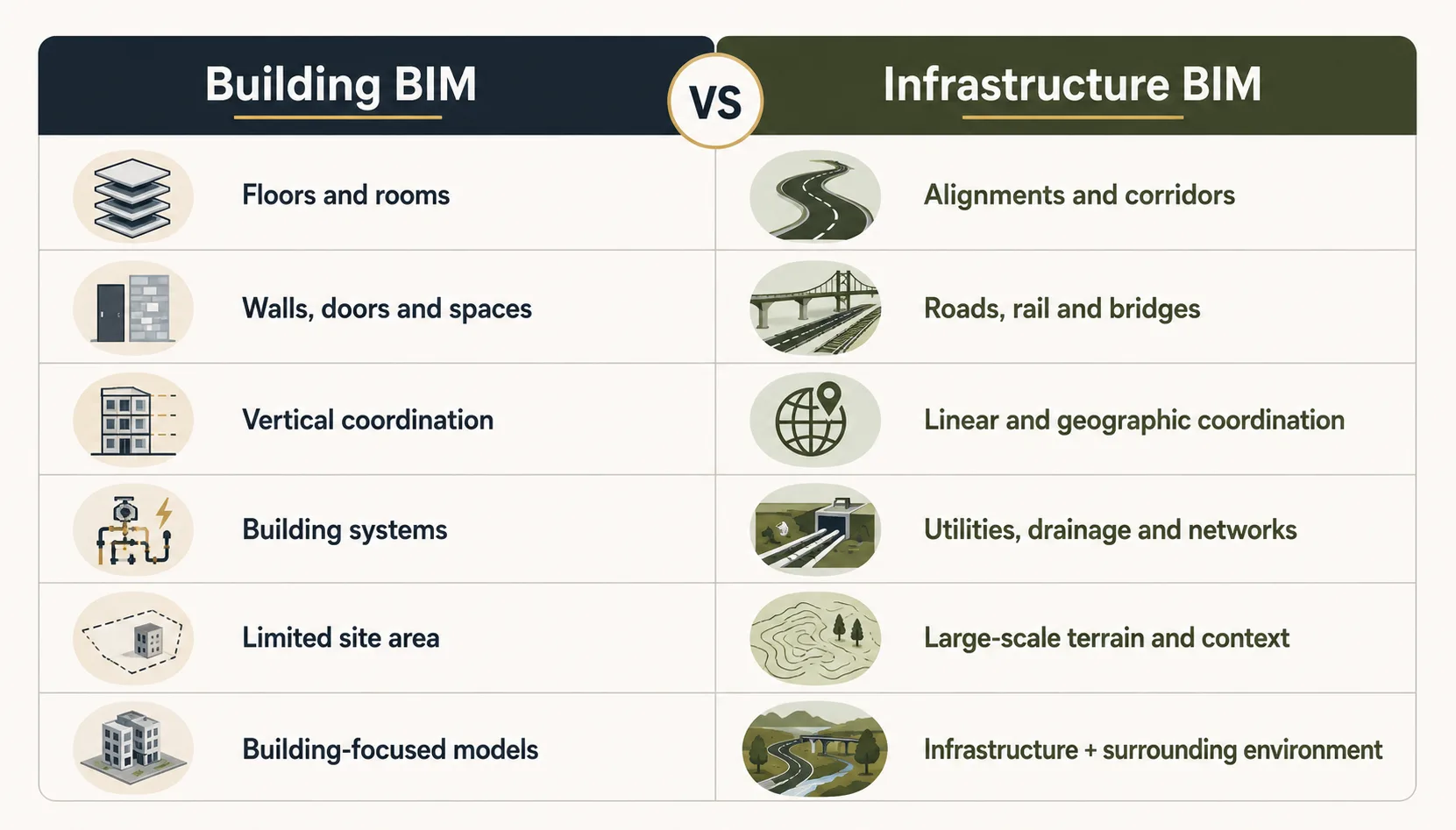
A building is usually organised around spaces, floors, rooms, and systems.
Infrastructure works differently.
A road project may involve alignments, profiles, corridors, terrain, drainage, utilities, intersections, structures, and large geographic areas.
A railway project adds another layer of complexity through tracks, stations, signalling, structures, and long linear corridors.
So the BIM mindset changes.
The important point is that Infrastructure BIM is not simply “Revit for roads.”
It involves different data, workflows, engineering requirements, and ways of coordinating a project.
Where Is BIM Being Used in Infrastructure?
Infrastructure BIM can support many types of projects, including:
Roads & Highways
Corridor modelling, terrain, intersections, drainage, quantities, and construction documentation can be developed within connected digital workflows.
Bridges
Bridge geometry, alignments, structural information, surrounding terrain, and related road infrastructure can be coordinated digitally.
Rail & Metro
Rail projects involve long corridors, alignments, stations, structures, and interfaces that require coordination across disciplines.
Airports
Runways, terminals, roads, utilities, structures, and surrounding infrastructure create complex interfaces that benefit from coordinated digital information.
Utilities & Site Infrastructure
Water, drainage, sewer, and other networks need to work together with roads, structures, and existing site conditions.
Modern civil design platforms support workflows for roads, highways, rail, bridges, terrain, and related infrastructure documentation.
3. The Terrain Changes Everything
Here's one of the biggest differences between building BIM and infrastructure BIM:
The ground is part of the project.
For a building, the site may be the context around the structure.
For a highway, railway, or large infrastructure corridor, the terrain itself can directly influence design.
Engineers need to understand:
- Existing ground conditions
- Survey information
- Elevations
- Alignments
- Profiles
- Slopes
- Corridors
- Drainage
- Surrounding infrastructure
This is why survey data, terrain modelling, GIS, and engineering design become important parts of infrastructure workflows. Civil 3D, for example, supports terrain, survey, corridor, road, rail, and infrastructure design workflows.
4. It's Not Just 3D Modelling
This is where many beginners misunderstand BIM for infrastructure.
The objective isn't simply to create an impressive 3D representation.
Infrastructure BIM can connect:
The model becomes part of a larger information workflow.
That is why infrastructure BIM is closely connected to digital project delivery, rather than being simply a visualisation exercise.
5. The Software Landscape Looks Different Too
If your experience with BIM is mainly through architectural projects, you may be more familiar with Revit.
Infrastructure projects often involve a broader toolset.
Civil 3D
Used for civil engineering design and documentation, including roads, sites, rail, terrain, corridors, and related workflows.
InfraWorks
Useful for conceptual infrastructure planning, context modelling, visualisation, and early design decisions within the built and natural environment.
GIS
Geographic Information Systems can provide valuable location-based information and help connect infrastructure models with their real-world context. Autodesk and Esri, for example, describe BIM-GIS integration as an important part of infrastructure workflows.
Revit and Other Platforms
Revit can still play a role where infrastructure projects involve buildings, stations, structures, or other components requiring building-oriented BIM workflows.
The important lesson?
Infrastructure BIM is rarely about one software package. It's about connecting the right information and workflows.
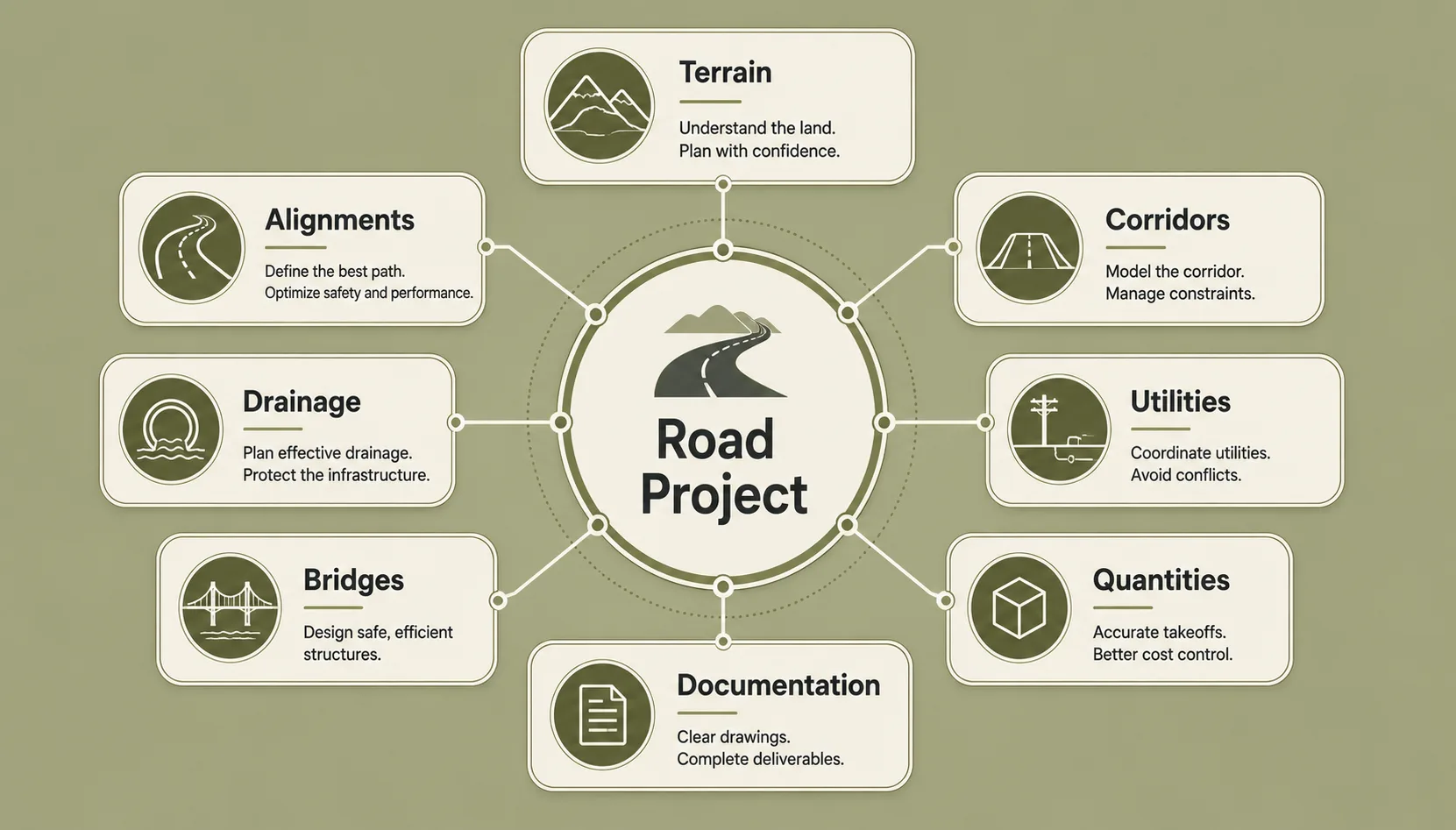
6. A Road Project Is More Than a Road
Imagine designing a new highway.
It isn't simply:
Draw road → Create model → Finish.
The project may involve:
- Existing terrain
- Survey information
- Horizontal alignment
- Vertical profile
- Corridors
- Intersections
- Drainage
- Utilities
- Bridges
- Roadside elements
- Quantities
- Construction documentation
And these components need to work together.
Change the alignment?
You may affect the corridor.
Change the corridor?
You may affect quantities.
Change the elevation?
You may affect drainage.
Move a structure?
You may affect the surrounding road and utilities.
That's the coordination challenge of infrastructure BIM.
7. Infrastructure BIM Is Also About Scale
A building project may involve a few disciplines working within a defined site.
An infrastructure project can extend across kilometres or even larger regional networks.
That creates different challenges:
More geographic information
The project needs accurate spatial context.
More interfaces
Roads intersect with bridges, utilities, railways, drainage systems, and existing infrastructure.
More stakeholders
Government agencies, consultants, contractors, utility providers, transport authorities, and local bodies may all be involved.
Longer project lifecycles
Infrastructure assets are expected to operate for decades.
This makes information management and digital delivery increasingly important.
8. Infrastructure BIM Is Moving Toward Digital Twins
The infrastructure journey doesn't necessarily end when construction finishes.
A well-developed digital information environment can support later stages such as:
Construction → Handover → Operations → Maintenance → Asset Management
This creates opportunities for digital twins, where digital representations can be connected with operational information and real-world asset data.
For major infrastructure, that could eventually mean using digital information to support the management of roads, bridges, rail systems, airports, utilities, and other assets throughout their operational life.
Autodesk describes infrastructure BIM as supporting the project lifecycle, while its transportation workflows increasingly connect BIM, GIS, collaboration, and digital project delivery.
9. What Does This Mean for Civil Engineers?
This is where the topic becomes particularly relevant to students.
A Civil Engineering graduate already understands concepts such as:
- Surveying
- Structures
- Roads
- Construction
- Materials
- Site conditions
- Engineering drawings
Adding digital construction skills can create another layer of capability.
A civil professional who understands Infrastructure BIM + engineering fundamentals can potentially contribute to:
- BIM modelling
- Civil design
- Infrastructure coordination
- Digital project delivery
- Model-based documentation
- Quantity workflows
- Infrastructure planning
- BIM coordination
The goal isn't to replace engineering knowledge with software.
It's to combine engineering knowledge with digital workflows.
10. Infrastructure BIM vs Building BIM: The Bigger Picture
Think of it this way:
Building BIM asks:
How do all the systems inside this building work together?
Infrastructure BIM asks:
How does this entire system work across the landscape?
That difference changes the scale, data, modelling approach, coordination requirements, and project workflows.
And that's exactly why Infrastructure BIM is becoming an important area of digital construction.
11. What Should Future Infrastructure BIM Professionals Learn?
If you're a Civil Engineer or graduate considering this field, don't focus only on learning commands.
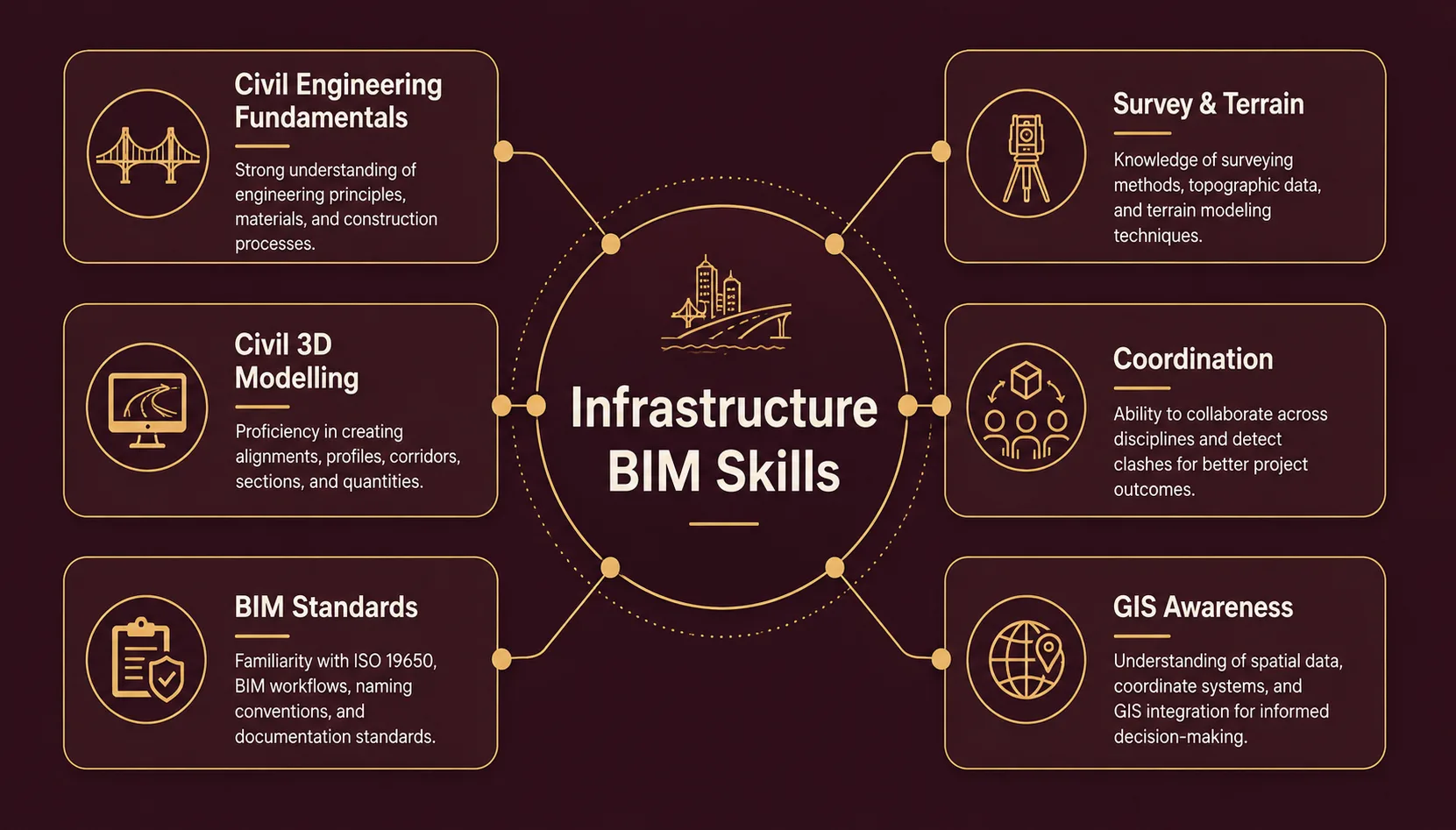
Build a broader skill set around:
Civil Engineering Fundamentals + Survey & Terrain Understanding + Civil 3D / Infrastructure Modelling + Infrastructure Coordination + BIM Standards & Documentation + GIS Awareness + Digital Project Delivery
That combination is much more valuable than simply adding another software certificate to your CV.
12. The Bigger Shift
The future of BIM isn't limited to taller buildings or more detailed Revit models.
It is also about connecting entire physical systems.
Roads connect cities.
Railways connect communities.
Bridges connect regions.
Airports connect countries.
Utilities support everything around them.
As these assets become more digitally planned, designed, constructed, and managed, Infrastructure BIM will become an increasingly important part of digital construction.
And for Civil Engineers, that's a significant opportunity.
Final Thoughts
BIM has moved beyond the building.
The next time you see a highway, metro line, bridge, or airport, remember that the visible infrastructure is only the final result.
Behind it are layers of:
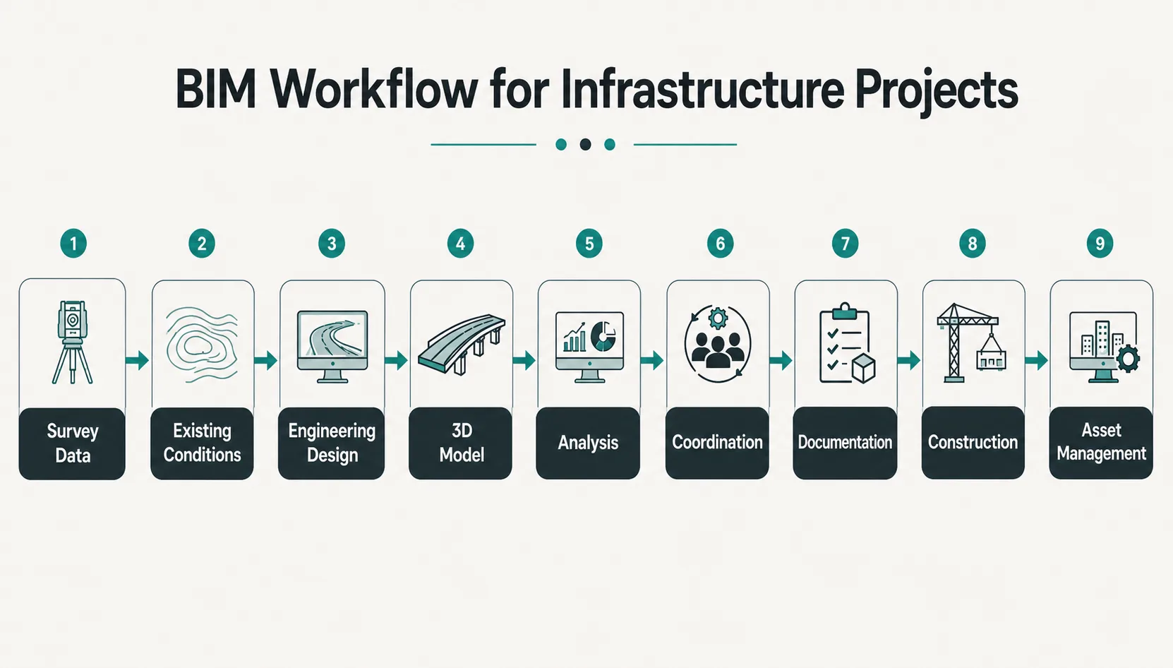
Survey data → Engineering design → Models → Coordination → Analysis → Documentation → Construction → Asset information
That's the real potential of Infrastructure BIM.
For Civil Engineers and aspiring BIM professionals, the opportunity isn't simply to learn another software platform.
It's to understand how engineering, geography, data, and digital construction come together to deliver infrastructure at scale.
Frequently Asked Questions
What is Infrastructure BIM?
Infrastructure BIM is a digital, model-based approach to planning, designing, coordinating, documenting, constructing, and managing infrastructure assets such as roads, bridges, railways, airports, utilities, and other civil works.
How is Infrastructure BIM different from Building BIM?
Building BIM commonly focuses on buildings and their architectural, structural, and MEP systems. Infrastructure BIM often deals with linear assets, terrain, geographic context, alignments, corridors, networks, and large-scale infrastructure systems.
Is Civil 3D a BIM software?
Civil 3D provides a model-based civil engineering environment used for infrastructure design and documentation, including roads, rail, terrain, corridors, and other civil workflows.
Is Revit used for infrastructure projects?
It can be. Infrastructure projects may include buildings, stations, structures, and other components where Revit can form part of a broader multidisciplinary workflow. The software used depends on the project's scope and requirements.
What should a Civil Engineer learn for Infrastructure BIM?
A strong foundation includes civil engineering principles, drawings, survey and terrain concepts, infrastructure modelling, coordination, BIM workflows, documentation, and relevant tools such as Civil 3D. GIS awareness can also be valuable for projects involving geographic data.
Is Infrastructure BIM a good career option for Civil Engineers?
It can be a strong option for Civil Engineers interested in digital construction, infrastructure design, technology, coordination, and large-scale projects. The most valuable profile combines engineering fundamentals with practical digital project skills.
Premium BIM Course
Professional BIM Course
Master BIM Course
Structural Design Concepts and BIM
Revit MEPF Master Course
MEP Design Fundamentals
Certified MEPF BIM Master Course
Electrical BIM Professional Program
RenderLab – Master 3D Modeling & Photorealistic Rendering
Multi-Tool Mastery for Architects & Engineers
BIM Coordinator Workflow Program
BIM FastTrack – 30 Day Intensive Training
Global Architectural & Structural BIM Project Program