Smart Roads Ahead: Bentley & Google Partner to Revolutionize Infrastructure Monitoring with AI & Street View
April 14, 2025
2 Min Read
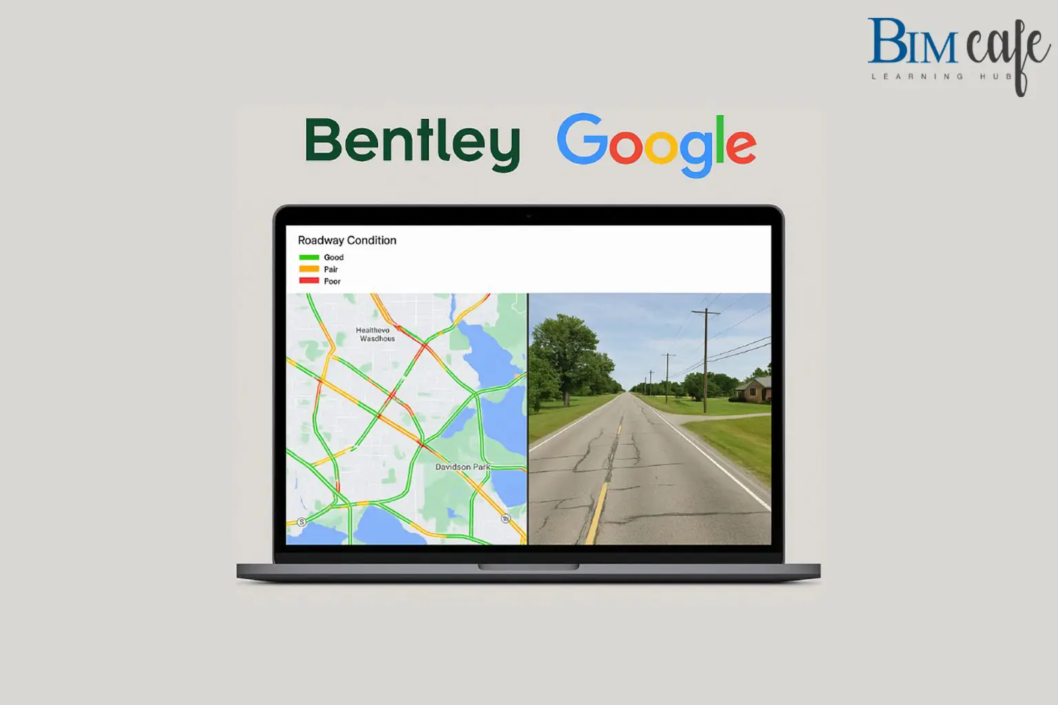
In an exciting leap forward for smart infrastructure, Bentley Systems has unveiled enhanced asset analytics capabilities powered by Google Maps Platform imagery. This groundbreaking collaboration promises to transform how Departments of Transportation (DOTs) and infrastructure professionals monitor, maintain, and respond to roadway conditions.
By integrating Google Street View, Vertex AI, and Blyncsy, Bentley’s new Imagery Insights solution offers a powerful combination of AI-driven analytics and high-resolution panoramic imagery. This enables real-time monitoring and predictive maintenance of roadway assets, reducing costs, increasing safety, and enabling faster disaster response.
What This Means for the Future of Infrastructure:
- Proactive Maintenance: DOTs can now anticipate and address issues before they become safety hazards, thanks to AI models trained on historical data and up-to-date visual inputs.
- Faster Disaster Recovery: Post-disaster assessments can be conducted quickly and cost-effectively, speeding up the path to rebuilding.
- Global Impact: These innovations aren’t just limited to transportation. Bentley aims to expand these analytics capabilities to other industries, empowering more sectors with smarter infrastructure solutions.
Voices from the Leaders:
“The addition of Google’s 360-degree imagery and AI will further enhance the value Bentley provides to transportation departments and engineering firms globally,” said Mark Pittman, Director of Transportation AI at Bentley.
“Bentley combines industry-leading infrastructure solutions with Google’s AI and mapping technologies to bring powerful analytics to public and private sector leaders,” added Yael Maguire, VP and GM, Google Maps Platform & Google Earth.
At BIM Cafe Learning Hub, we’re thrilled to witness cutting-edge technologies reshaping the infrastructure landscape. This breakthrough also opens exciting new frontiers in BIM-integrated asset management and AI-powered infrastructure planning—key themes we actively explore in our advanced training programs.
Stay tuned for more updates from the intersection of BIM, AI, and smart cities—right here at BIM Cafe.