Author: Devika R
March 19, 2026
5 min read
Traditionally, documenting an existing building meant multiple site visits, manual measurements, and a lot of back-and-forth.
Today, that process is changing.
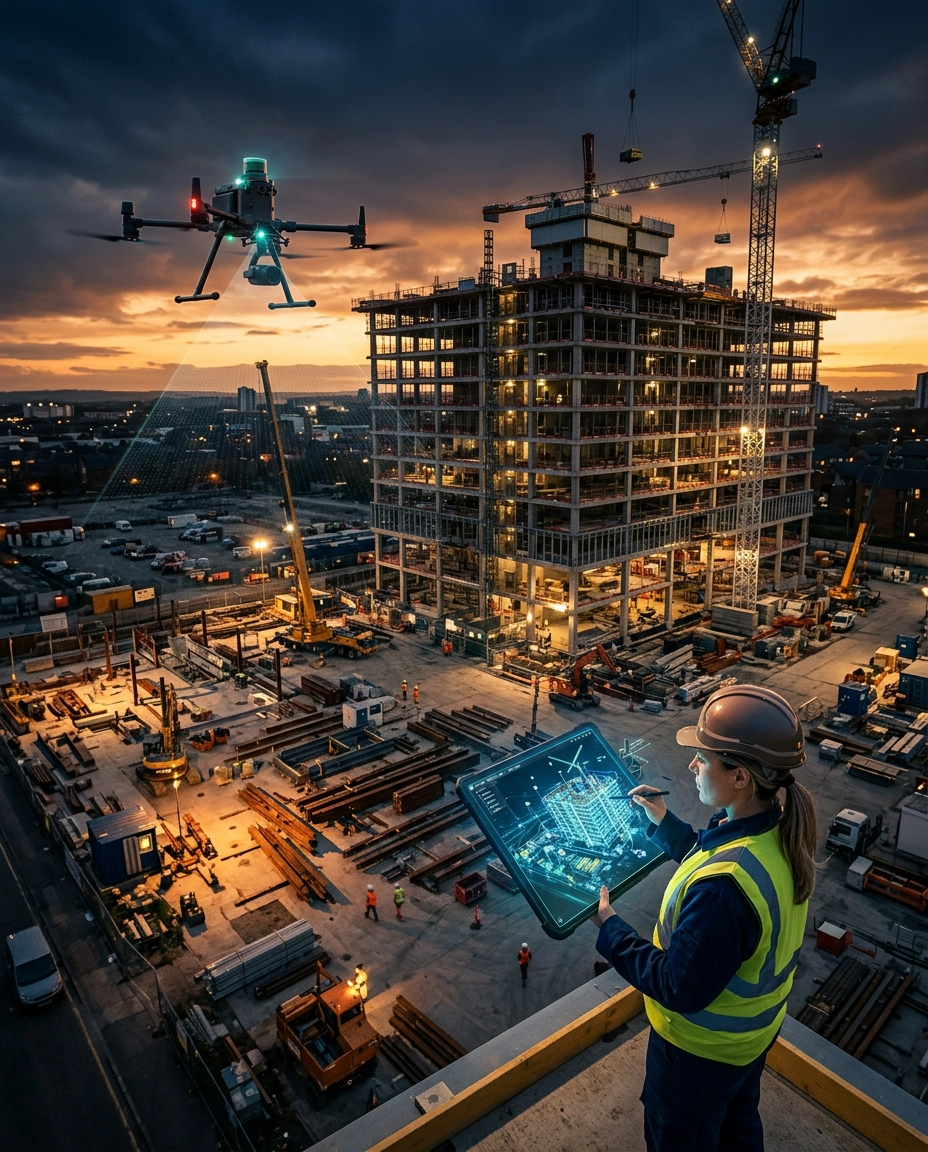
With the rise of reality capture technologies, professionals can now scan a building once and access it anytime — remotely, accurately, and in detail.
One of the most widely used tools in this space is Matterport.
If you're planning a career in BIM, understanding how tools like Matterport fit into real workflows is becoming increasingly important.
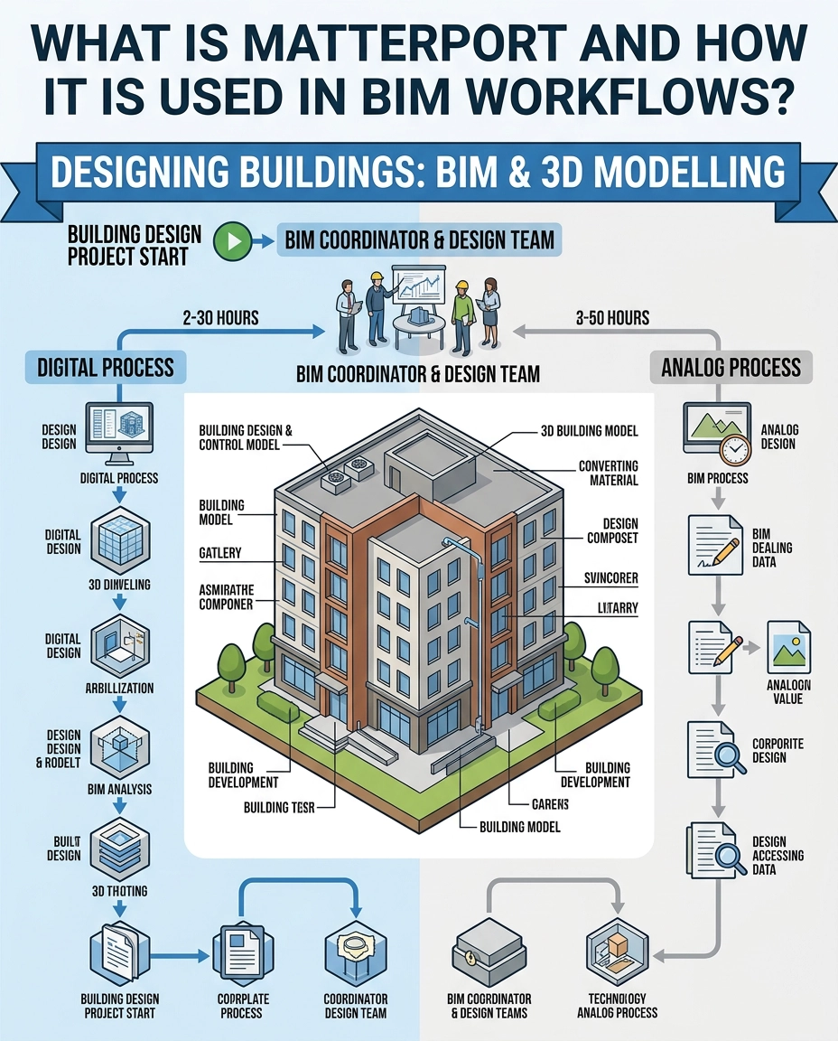
What is Matterport?
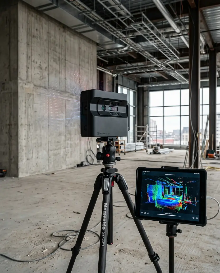
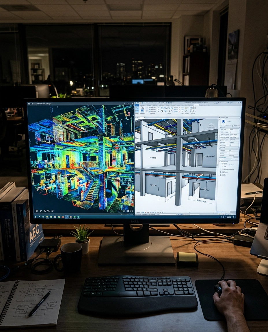
Matterport is a 3D reality-capture platform that lets you create a digital version of real-world spaces.
Using specialised cameras or LiDAR-enabled devices, it captures the geometry of a building and converts it into an interactive 3D model. What you get is not just a model — but a fully navigable digital environment.
A typical Matterport output includes:
- ✔Interactive 3D walkthrough
- ✔Dollhouse view of the building
- ✔360° panoramic views
- ✔Auto-generated floor plans
- ✔Basic measurement tools
This allows architects, engineers, and BIM professionals to explore a site without being physically present.
How Matterport Fits into BIM Workflows
It's important to understand one thing clearly:
👉 Matterport is not BIM software — but it plays a crucial role in Scan-to-BIM workflows.
Here's how it works in real projects:
Instead of starting from scratch, BIM professionals use the scanned data as a reference base to create accurate models.
This approach is especially useful for:
- ✔Renovation projects
- ✔As-built documentation
- ✔Facility management
- ✔Retrofit design
📖 Want a deeper understanding of how this process works? Read our blog: The Real Scan-to-BIM Process: What Most People Don't See →
Why Matterport Is Becoming Popular in AEC
Across the US, Europe, and now in India, firms are increasingly adopting Matterport. The reason is simple — it solves real problems.
This makes decision-making faster and more accurate.
Matterport vs Traditional BIM Entry
| Traditional Approach | With Matterport |
|---|---|
| Manual measurements on site | Single scan captures full geometry |
| Reliance on 2D drawings | Interactive 3D environment as reference |
| Site sketches prone to error | Millimetre-accurate point cloud data |
| Assumption-based modeling | Data-driven modeling |
This shift reduces errors and improves model reliability — which is exactly what clients and project managers expect today.
Why BIM Professionals Should Learn This
If you're planning to work on international BIM projects — especially in the Middle East, US, or Europe — understanding reality capture workflows gives you a strong advantage.
Because today, companies are not just looking for people who can model. They want professionals who understand how data is captured and used.
📖 This is also why many recruiters now expect knowledge beyond just Revit. Read: What BIM Recruiters Will Actually Hire You For in 2026 →
How BIM Cafe Prepares You for Industry Workflows
At BIM Cafe Learning Hub, the focus is not limited to software training. We train students to understand real BIM workflows used in the industry, including:
- ✔Scan-to-BIM processes
- ✔Coordination workflows
- ✔LOD-based modeling
- ✔Documentation and project delivery
Our programs are designed to take you from basic modeling to real project execution.
🔮 The Future of Scan-to-BIM and Reality Capture
Reality capture is no longer optional — it's becoming a standard across the AEC industry.
With technologies like Matterport, LiDAR scanning, and drone mapping, the BIM workflow is evolving into a data-first approach.
In the near future, BIM professionals will not just model buildings — they will work with digital twins of real-world environments.
Final Thoughts
Matterport is not replacing BIM — it is strengthening it.
It helps bridge the gap between real-world conditions and digital models. For students and professionals, this means one thing:
To stay relevant, you need to understand not just how to model, but also where your data comes from. That's what makes you industry-ready.
Ready to Learn Industry-Ready BIM Workflows?
Explore BIM Cafe's project-based programs and train with real-world workflows from day one.
Explore BIM Courses →